RIGHTS OF WAY IN SULGRAVE
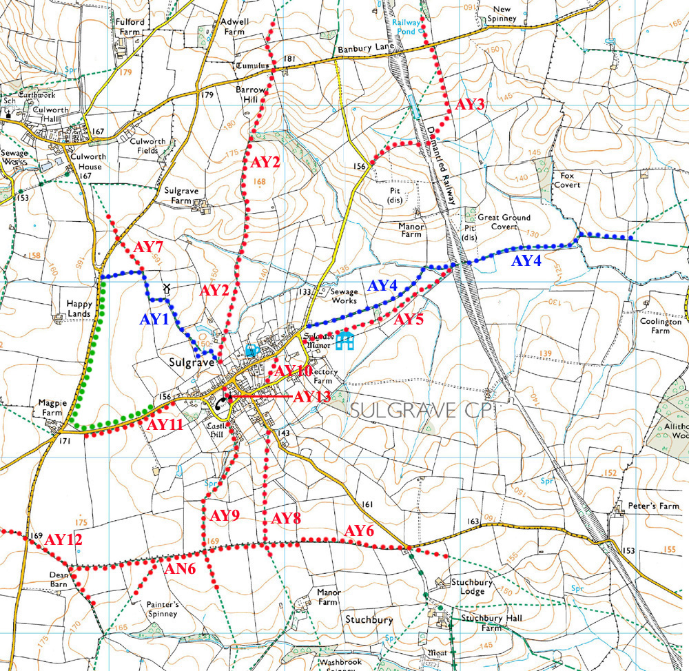
The map below shows all public rights of way within the Parish of Sulgrave. It is derived from the Northamptonshire County Council's "Rights of Way Definitive Map" of 1st July 2005.
Footpaths are shown in red dots.
Bridleways are shown in blue dots.
A "Permissive Bridleway" is shown in green dots. See here for more details.
The Parish Boundary is shown in small black dots.
In order to preserve sufficient detail the map is of a size that will more than fill most computer screens. Use your computer's scroll bars to follow any particular right of way of interest to you.
The map is based on images produced from the Ordnance Survey Get-a-map service and is reproduced by kind permission of Ordnance Survey and Ordnance Survey of Northern Ireland. For use "in the field" the Ordnance Survey's excellent 1:25,000 (app 2.5 inches to 1 mile) "Explorer" Series is recommended. These are to the same scale as the map shown below and the sheet covering the whole of Sulgrave Parish is No. 206 (Edge Hill and Fenny Compton).
